Trivia about the Baguio City
In 1900, when the Americans first came to baguio, it was the only “rancheria,” whose dominant feature was a large, low-lying area Kafagway. There were only a few houses and no roads. During the dry season it was a pasture for cattle and horses, but much of the year, it was marshland with a shallow lake where residents hunted for ducks and snipes. Kafagway roughly covered the same area as the present city of Baguio.
The Americans found Baguio an ideal site for a future city and summer retreat from the sweltering heat of the lowlands. The hill were grassy and studded with pine trees. It had a cool weather and pleasant climate. The Americans also found a good source of water to supply the needs of the city. Hence, Governor William Howard Taft did not hesitate to propose that this be the location for the summer capital and health resort of the Philippines.
In November 1900, the Americans established the first civil government in Benguet. Kafagway was designated as the capital and later renamed to Baguio, apparently derived from the Ibaloi word ” bigiw,” which is mosslike green plant that grew around the area where Bumham Park is now located. Plans were immediately made to construct the first road to connect Manila with the mountain region. The project started 1901 and Major Lyman Kennon was designated to supervise the construction of the Bued Canyon route later called the Benguet Road. This access road, completed in three years was renamed Kennon Road in honor of its builder.
On June l, 1903, the American colonial government passed a resolution naming the town of Bagiuo as the summer capital of the Philippine Archipelago. The resolution called for the construction of suitable buildings, the establishment of 19 townships, and putting up of appropriate transportation. Soon after a ptran for rapid development framework for Baguio was hatched. This was supported by the enactment of a city charter that provided fiscal, territorial and administrative frameworks adopted on September 1, 1909. The scenic Kennon Road, with its zigzag pathways carved out of mountain slopes, served as a major access to the mineral-rich mountains of the Cordilleras, trigging a mining boom until the mid 1903’s. Baguio was a direct beneficiary of the economic growth that was felt all over the country.
After the devastation of World War II, a fast-paced development transformed Baguio into an educational center north of Manila, a trade and tourism hub, and a regional administrative center. Even in the aftermath of a major earthquake that struck Baguio in 1990, it has since bounced back into a bustling and vibrant city once again.
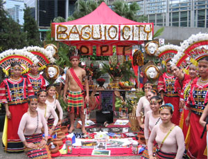
Even until today, in its centennial year, the City of Baguio is the premier tourist destination in the country with its cool climate, foggy hills, panoramic view, pine-smelling roads, and blooming flowers. Baguio still continues to be a melting pot of different peoples and cultures from neighboring highland places.
Stamps, Souvenir Sheets and Official First Day Covers will be available starling Sept. 1, 2A09 at the Postage and Philateiic Department, Door 203, Liwasang Bonifacio, 1000 Manila and at all Regional Offices of the Philippine Postal Corporation.

Recent Comments